|
Indigenous people: Chamorros (Chamorus), who first settled the island about 4,000 years ago.
Capital: Hagåtña
Leadership: Governor Eddie Baza Calvo, Lt. Gov. Ray Tenorio, Congressional Delegate Madeleine Z. Bordallo, Legislative Speaker Judith Won Pat, Chief Justice Robert J. Torres, Attorney General Leonardo M. Rapadas.
Political Status: Organized, unincorporated territory of the United States since 1950. Considered a US colony and was previously a colony of Spain, the US, Japan and then the US again after World War II.
Economy: Mainly supported by tourism particularly from Japan, Korea and the United States armed forces. The US military is the secondary economic force.
Slogans: Tano I’ ManChamorro (Land of the Chamorros). As the United States westernmost territory: “Where America’s Day Begins.”
Villages: Asan-Maina, Agana Heights, Agat, Barrigada, Chalan Pago-Ordot, Dededo, Hagåtña, Inarajan, Mangilao, Merizo, Mongmong-Toto-Maite, Piti, Santa Rita, Sinajana, Talofofo, Tamuning-Tumon, Umatac, Yigo, and Yona.
Land Area: 214 square miles ( 549 square kilometers ) including outlying islands.
Location: Latitude 13.28 degrees North and Longitude 144.47 East, largest and southernmost of the Mariana Islands in the Micronesian region of the Pacific.
Official Languages: English and Chamorro
Time: Chamorro Standard Time (Greenwich Mean Time +10)
Population: 159, 358 (2010 US Census)
Currency: US Dollar
Climate: Between 75-86 degrees Fahrenheit (26-30 degrees Celsius) Averaging 81 degrees Fahrenheit (28 degrees Celsius)
Seasons: Dry season between January and May; Rainy season between August and November.
Rainfall: Annual average is approximately 80 inches (2,509 millimeters)
Guam Territorial Bird: Ko’ko’ or Guam Rail.
Guam Territorial Tree: Ifit or Ifil (Intsia Bijuga).
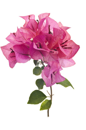
Guam Territorial Flower: Puti tai nobio or Bougainvillea.
source: http://guampedia.com
Capital: Hagåtña
Leadership: Governor Eddie Baza Calvo, Lt. Gov. Ray Tenorio, Congressional Delegate Madeleine Z. Bordallo, Legislative Speaker Judith Won Pat, Chief Justice Robert J. Torres, Attorney General Leonardo M. Rapadas.
Political Status: Organized, unincorporated territory of the United States since 1950. Considered a US colony and was previously a colony of Spain, the US, Japan and then the US again after World War II.
Economy: Mainly supported by tourism particularly from Japan, Korea and the United States armed forces. The US military is the secondary economic force.
Slogans: Tano I’ ManChamorro (Land of the Chamorros). As the United States westernmost territory: “Where America’s Day Begins.”
Villages: Asan-Maina, Agana Heights, Agat, Barrigada, Chalan Pago-Ordot, Dededo, Hagåtña, Inarajan, Mangilao, Merizo, Mongmong-Toto-Maite, Piti, Santa Rita, Sinajana, Talofofo, Tamuning-Tumon, Umatac, Yigo, and Yona.
Land Area: 214 square miles ( 549 square kilometers ) including outlying islands.
Location: Latitude 13.28 degrees North and Longitude 144.47 East, largest and southernmost of the Mariana Islands in the Micronesian region of the Pacific.
Official Languages: English and Chamorro
Time: Chamorro Standard Time (Greenwich Mean Time +10)
Population: 159, 358 (2010 US Census)
Currency: US Dollar
Climate: Between 75-86 degrees Fahrenheit (26-30 degrees Celsius) Averaging 81 degrees Fahrenheit (28 degrees Celsius)
Seasons: Dry season between January and May; Rainy season between August and November.
Rainfall: Annual average is approximately 80 inches (2,509 millimeters)
Guam Territorial Bird: Ko’ko’ or Guam Rail.
Guam Territorial Tree: Ifit or Ifil (Intsia Bijuga).
Guam Territorial Flower: Puti tai nobio or Bougainvillea.
source: http://guampedia.com
